 Image 1 of 2
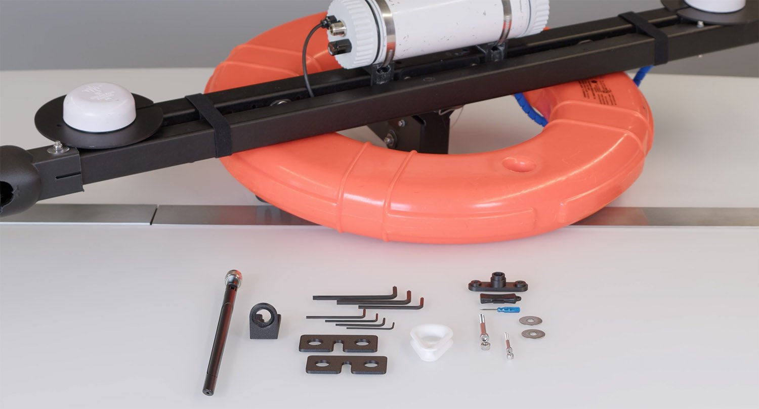 Image 2 of 2
From Price: €8,290.00
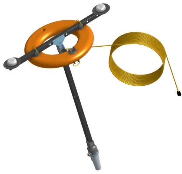
The Omnitrack Underwater Positioning System is a modern, high‑precision solution for tracking and positioning underwater vehicles and assets. Designed for professional marine operations, Omnitrack combines advanced surface positioning technology with seamless ROV integration to deliver reliable and repeatable underwater navigation.
At the heart of the system is a rugged surface positioning buoy, engineered to operate as a stable reference point on the water. Equipped with dual GNSS receivers, the surface module provides highly accurate global positioning while simultaneously calculating true heading. This dual‑GNSS design removes common errors caused by magnetic interference, ensuring dependable orientation in challenging environments.
The surface unit works in conjunction with an integrated acoustic locator to precisely track underwater targets. This makes Omnitrack ideal for:
ROV navigation and survey missions
Inspection and mapping tasks
Scientific research and offshore operations
Omnitrack is designed to interface directly with BlueROV systems, significantly improving the vehicle’s internal position estimation. For enhanced performance, the system can also be paired with a Tracker‑650 DVL, enabling smoother navigation and higher accuracy during complex underwater maneuvers.
To suit different operational needs, the surface module is available in both:
Wired configurations for maximum stability
Wireless configurations for rapid deployment and operational flexibility
High‑accuracy GNSS‑based surface positioning
True heading without magnetic interference
Improved ROV navigation and situational awareness
Compatible with BlueROV and optional DVL systems
Designed for professional and research‑grade applications
From Price: €8,290.00
The Omnitrack Underwater Positioning System is a modern, high‑precision solution for tracking and positioning underwater vehicles and assets. Designed for professional marine operations, Omnitrack combines advanced surface positioning technology with seamless ROV integration to deliver reliable and repeatable underwater navigation.
At the heart of the system is a rugged surface positioning buoy, engineered to operate as a stable reference point on the water. Equipped with dual GNSS receivers, the surface module provides highly accurate global positioning while simultaneously calculating true heading. This dual‑GNSS design removes common errors caused by magnetic interference, ensuring dependable orientation in challenging environments.
The surface unit works in conjunction with an integrated acoustic locator to precisely track underwater targets. This makes Omnitrack ideal for:
ROV navigation and survey missions
Inspection and mapping tasks
Scientific research and offshore operations
Omnitrack is designed to interface directly with BlueROV systems, significantly improving the vehicle’s internal position estimation. For enhanced performance, the system can also be paired with a Tracker‑650 DVL, enabling smoother navigation and higher accuracy during complex underwater maneuvers.
To suit different operational needs, the surface module is available in both:
Wired configurations for maximum stability
Wireless configurations for rapid deployment and operational flexibility
High‑accuracy GNSS‑based surface positioning
True heading without magnetic interference
Improved ROV navigation and situational awareness
Compatible with BlueROV and optional DVL systems
Designed for professional and research‑grade applications